


Traffic in transboundary water bodies
In Estonia the transboundary water bodies are the Narva river, the Narva Water Reservoir, the lake Peipsi, Pihkva and Lämmijärv....
Moving at sea
Before you go out to the sea: • Check the technical conditions of floating vessel and navigation equipment...
Navigation in foreign waters
Within the Schengen visa zone, people can arrive and leave the state via any ports. NB! It is necessary to carry always the identification...
Ask your question:
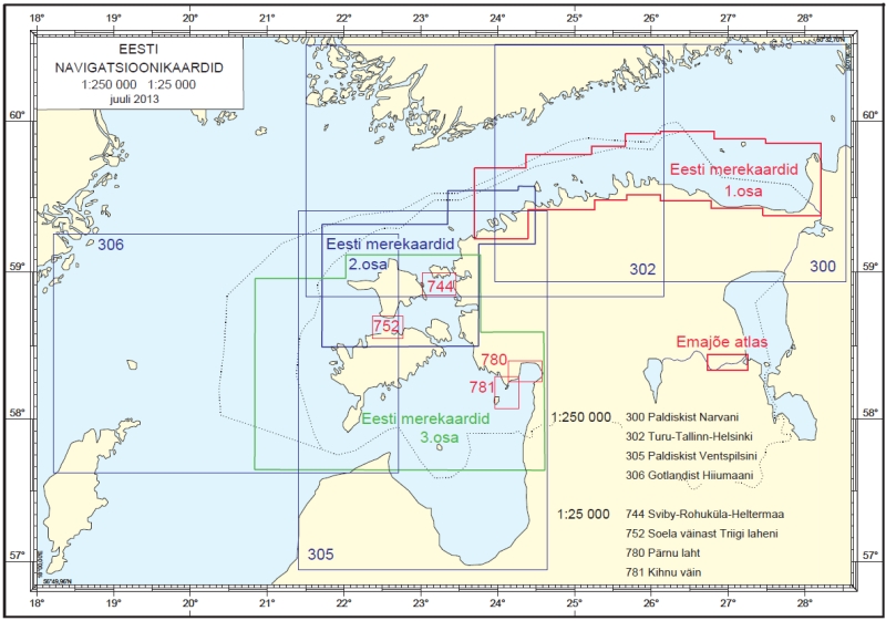
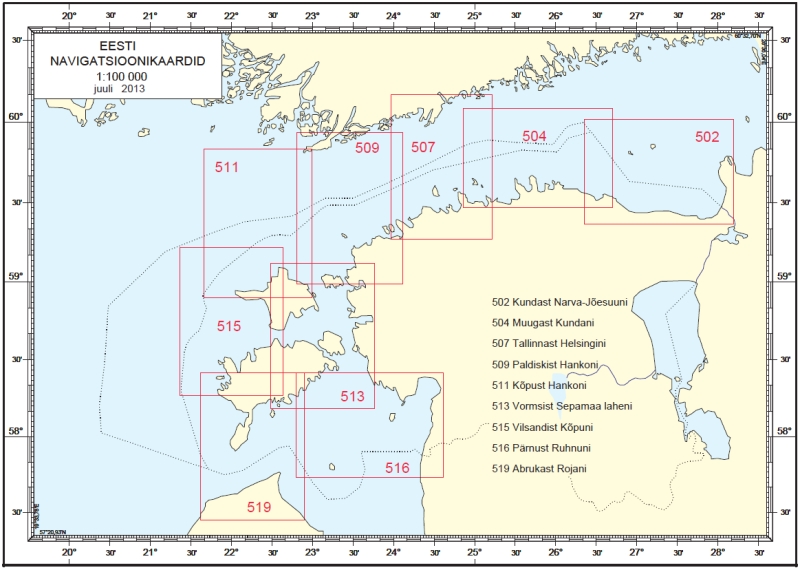
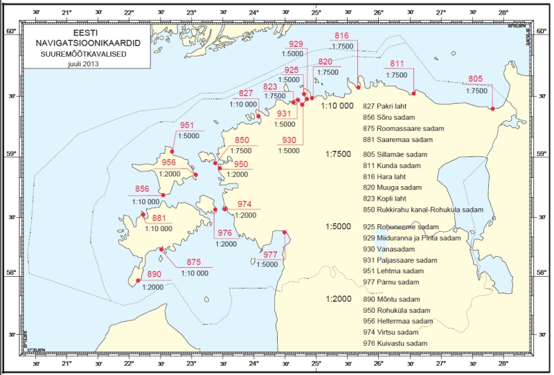
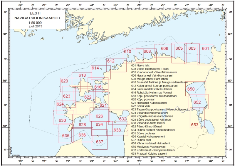
Charts
In this section are presented differents nautical Mercator charts in scales:
Plans in scale 1:500 - 1:10,000 are provide guidance for ships in ports, harbors, bays, on raids, etc.
Charts in scale 1:10 000 - 1:75 000 are designed to ensure the safety of navigation in areas with difficult navigation and hydrographic, in narrow areas in the archipelago, in close proximity to the coast, etc.
Maps inscale 1:100 000 - 1:500 000 are used to provide navigation between ports in sight and out of sight of the coast and coastal landmarks. However, due to the large scale, they depict only the most significant hazards and objects, so this type of card is not recommended for coastal navigation.
Choose appropriate type and navigation area charts you can by cartograms or by using the left menu.